Service
HYDROGRAPHIC & GEOPHYSICAL MAPPING
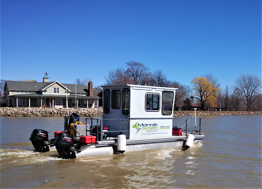
We offer nationwide hydrographic and geophysical survey services, delivering high-resolution, geo-referenced data for lakes, rivers, harbors, canals, estuaries, and marine environments. Our expertise includes multi-beam and single-beam sonar bathymetry, side scan sonar, sub-bottom profiling, and magnetometer surveys.
Multibeam Bathymetry
MSG uses advanced hydrographic instruments and software to provide multi-beam sonar bathymetry of lakes, harbors, rivers, canals, estuaries, and marine environments.
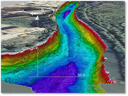
Multi-beam sonar bathymetry is the preferred method when detailed bathymetric resolution of the seafloor, lakebed, river channel, or harbor is required. In addition to providing complete bathymetric coverage, multi-beam sonars have been successful for locating wrecks, debris, obstructions, artifacts, and substrate types.
MSG’s multi-beam sonar mapping is conducted in accordance with established methods and protocols to include those set forth by the US Army Corps of Engineers. Our Team of Scientists use the most advanced hydrographic and mapping software to collect and process accurate geo-referenced 3-D images of the bathymetry and underwater features.
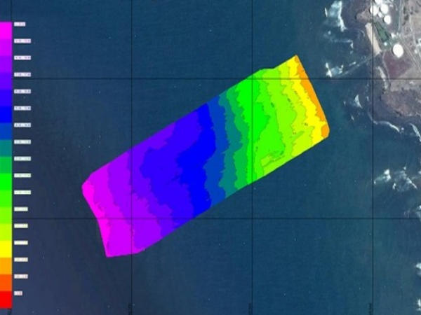
Our deliverables can be provided in various formats to enable convenient data sharing. Our multi-beam sonar deliverables can include geo-referenced backgrounds such as orthographic aerial photographs, engineering plans, land surveys, lidar topography, and other databases to show information relevant to the project.
MSG provides multi-beam sonar services nationwide and throughout the US territories.
SINGLE-BEAM SONAR BATHYMETRY
Specializing in precision environmental mapping, MSG uses advanced hydrographic instruments and software to provide single-beam bathymetric mapping of lakes, harbors, rivers, canals, estuaries, and marine environments.
MSG collects single-beam sonar data in accordance with established methods and protocols set forth by the US Army Corps of Engineers with better-than accuracy criteria.
MSG’s scientists and technicians use hydrographic software with onboard computers to interface RTK-GPS survey instruments with a survey-grade echosounder, to collect centimeter-accurate bathymetric data. Hydrographic software is used to develop the bathymetric data into contour drawings and other deliverables.
Our deliverables are provided in various formats to enable convenient data sharing and include geo-referenced backgrounds such as of orthographic aerial photographs, engineering plans, land surveys, lidar topography, and other databases to show information relevant to the project.
Sidescan Sonar
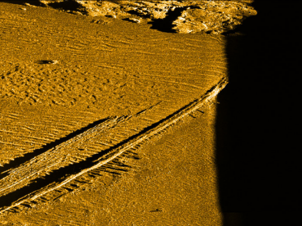
Side scan sonar surveys are the preferred method when high-resolution inspection is required. The exceptionally high resolution inspection provided by MSG’s side scan sonar services enables detailed underwater imagery mosaics that can be used to successfully locate wrecks, debris, obstructions, artifacts, and substrate types.
MSG utilizes a variety of sidescan systems to collect side scan data in both shallow and deep waters. All MSG’s systems use CHIRP technology for the best range and resolution, with specifications better-than that set forth by NOAA and the IHO. The sidescan systems can be hull-mounted or towed to survey water depths up to 200’. Co-registered interferometric multi-beam data can be collected simultaneously with certain side-scan systems.
SUB-BOTTOM PROFILING
Sub-bottom profiling is the preferred method to accurately measure the depth and thickness of substrates and accumulated sediments. While navigating survey transects, MSG’s scientists collect accurate GPS-referenced data of water depth, sediment depth (sub-bottom), and substrates using sub-bottom profiling technology.
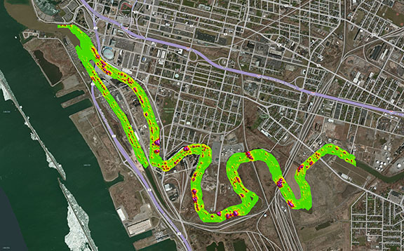
Sub-Bottom Profiling is useful for pre-dredge surveys of accumulated sediments; mapping of glacial till and substrates; development of groundwater transport models; locating buried wrecks, debris, and obstructions; locating buried pipelines or cables; and archeological surveys for buried artifacts.
MAGNETOMETER SURVEY
MSG uses a Geometrics G882 marine magnetometer and the most advanced hydrographic and mapping software produced by the industry’s leaders to conduct magnetometer surveys.
Magnetometer survey tracks are developed using hydrographic-geophysical software, at sufficient intervals to ensure coverage of the project area and detection of utility crossings and debris. The magnetometer surveys are conducted with RTK-GPS survey equipment in a client-specified coordinate system.
Our onsite Project Geophysicist verifies project coverage and the final compiling of the magnetometer data to include an accurate geospatial drawing depicting identified magnetic biases found at the project.
Deliverables include geo-referenced backgrounds such as existing orthographic aerial photographs, engineering plans, land surveys, and other databases to show information relevant to the project.